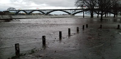
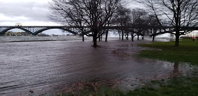
The Niagara Parkway was closed under the famous crossing between Canada and the United States as the area is prone to flooding. At first the high water levels and waves splashed against the concrete and block wall along the river, then the water gradually started to creep overland and onto the parkway. In the photo at top you can see the water as it starts to fill the parking lot at the foot of Queen Street, just off the Niagara Boulevard.
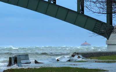
Niagara Peninsula Conservation Authority's December 10th special weather statement identified the following hazards; "Niagara is currently under a Special Weather Statement as issued by Environment Canada, calling for strong southwest winds gusting between 90-110km/hr beginning tonight and continuing on into Saturday evening. These strong southwesterly winds will increase water levels and waves along the entire Lake Erie shoreline. The Ministry of Northern Development, Mines, Natural Resources and Forestry is currently predicting water levels to increase above current levels on Lake Erie by approximately 1.8m (6.0ft), to an elevation 176.3m. Significant wave heights of approximately 1.8m (6.0ft) are also forecasted to occur all along the entire Lake Erie shoreline during this time. Water levels are forecast to peak Saturday evening around 8:00pm."
As of 6:30pm Dec 11 the Town of Fort Erie had posted the following road closures on their facebook page.
"The following roads are closed due to flooding, trees or power lines down. Please use a lot of caution if you have to be out.- Point Abino Road south of Erie Road
- Ridgeway Road at Crystal Beach Drive
- Lake Avenue at Crystal Beach Drive
- Terrace Lane
- Niagara River Parkway from Central Avenue to Queen Street (NPC)
- Lakeshore Road from Albert Street to Central Avenue
- Nigh Road from Mathews Road to Highway 3
- sunset Drive Garrison Road to Gilmore Road
- Bertie Street Pettit Road to Sunset Drive
- Thunder Bay Road Windmill Point Road to Nicolas Avenue
- Shirley Road Thunder Bay Road to Bethune Avenue
Crews are out working hard to clear the debris."


No comments:
Post a Comment